
Suriname is situated in the north of South America. It borders French Guiana in the east, Brasil in the south, Guyana in the west and the Atlantic Ocean in the north, and has an area of 163,265 square kilometres (63,064 square miles). The country contains many rivers and some mountains (highest point 1280 metres). The larger part of the country consists of uncultivated rain forest.
Nearly all 386,372 inhabitants of Suriname (1990 count) live within a 30 km wide coastal region. The capital Paramaribo lies about 20km south of the coast at the west bank of the Suriname river. It has 150,000 inhabitants.
Suriname has a tropical climate, with daily temperatures varying between 23 and 31 Centigrades. The year can be roughly divided in two rain seasons (April-August and November-February) and two dry seasons (February-April and August-November).
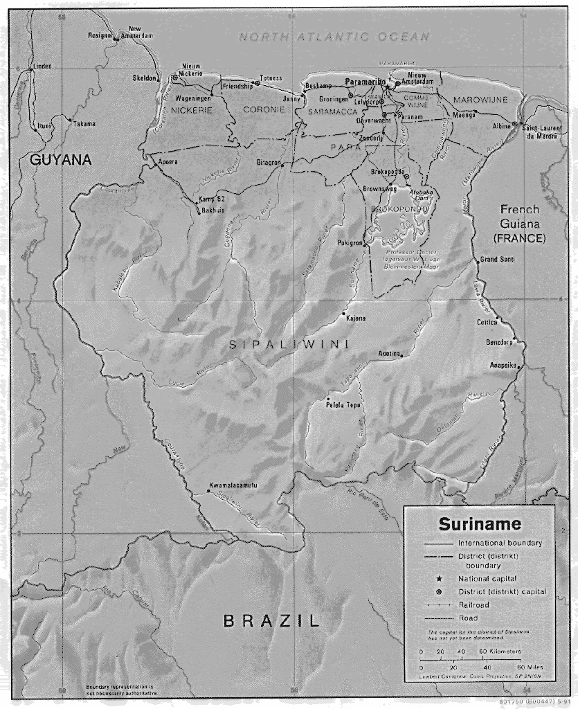
Suriname is divided in ten districts:
You can view the current district division of Suriname (gif file, 275 Kb). This map. was obtained from the Perry-Castañeda Library Map Collection at the University of Texas at Austin.